Store
Order now using your credit card or PayPal account. (Note: A PayPal account isn’t required. A credit card will work just fine.)
International buyers should contact the sales manager, [email protected], regarding shipping charges.
Order now using your credit card or PayPal account. (Note: A PayPal account isn’t required. A credit card will work just fine.)
International buyers should contact the sales manager, [email protected], regarding shipping charges.

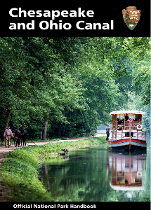
Handbook cover
C&O Canal Official National Park Handbook: Official national park handbooks are a series of reasonably priced user guides that provide historical background, descriptive details, and visitor information. In 2015 the C&O Canal Association published an update to the 1991 original which includes:
– Revised text that includes recent research about the canal’s history
– Features reflecting the improvements to the park
– New photographs that show the present-day canal features
– Updated maps

Williamsport area
David Edwards-May, Inland Waterways of North America. This folding map shows all the navigable waterways on the continent. The 2019 edition includes an inset for the C&O Canal. It also shows other abandoned canals that were so important to our history. Read more..

Pocket guide cover
Pocket Guide to the Chesapeake & Ohio Canal National Historical Park has been revised and reprinted, and is now available for sale.
This handy book is a great way to track progress during a walk or ride on the towpath and determine the location of a canal feature or access point. It lists 580 sites and features, includes canal maps, and provides space for user notes. A laminated cover provides improved durability over the earlier editions.
This revised edition is updated with improvements to the towpath, including the restoration of Big Slackwater and the Catoctin Aqueduct. It also features the Canal Quarters sites and Canal Towns.

Snyder book cover
Tim Snyder, Trembling in the Balance:The Chesapeake and Ohio Canal During the Civil War.
“With this book, Tim Snyder fills a major gap in the available sources on the C&O Canal. Although the canal was of enormous importance in remarkably diverse ways during the Civil War, that full story has never been written. It is a rare and remarkable story, and Tim Snyder tells it more fully and expertly than anyone has before.” – Karen M. Gray, Ph.D., C&O Canal historian

Hahn guide cover
Thomas F. Hahn, Towpath Guide to the C&O Canal: With new photos and research, updated maps, and a 21st century makeover, Thomas Hahn’s labor of love remains the most comprehensive mile-by-mile guide to the Chesapeake & Ohio Canal. Journey 184.5 miles past former wharfs and foundries on the Georgetown waterfront, through quaint Potomac River towns, to the mountainous region of Western Maryland, while exploring all of the canal locks, lockhouses, aqueducts, and culverts along the way.