List of Levels

For the purposes of the Level Walker Program, the 184.5 miles of the canal have been divided into 69 segments. Shown below is a complete list, with the level number, the landmark which marks the beginning of the level, the landmark which marks the end of the level, starting and ending milepoints, and the length of the level.

Level
No.
Level Name Start of Level End of Level Start Stop Miles
1 Georgetown Tidelock Incline Plane 0.00 2.26 2.26
2 Fletchers Incline Plane Lock 5 2.26 5.02 2.76
3 Brookmont–Glen Echo Lock 5 Cabin John Creek 5.02 7.50 2.48
4 Cabin John Cabin John Creek Lock 14 7.50 9.47 1.97
5 Seven Locks Lock 14 Bridge at Cropley 9.47 12.28 2.81
6 Widewater–Six Locks Bridge at Cropley Great Falls Tavern 12.28 14.30 2.02
7 Upper Great Falls Great Falls Tavern Lock 21 (Swains) 14.30 16.64 2.34
8 Swains Lock 21 (Swains) Lock 22 (Pennyfield) 16.64 19.63 2.99
9 Pennyfield Lock 22 (Pennyfield) Seneca Aqueduct 19.63 22.82 3.19
10 Seneca Seneca Aqueduct Milepost 25 22.82 25.00 2.18
11 Tenfoot Island Milepost 25 Sycamore Landing 25.00 27.21 2.21
12 Mckee-Beshers Sycamore Landing Edwards Ferry 27.21 30.84 3.63
13 Edwards Ferry Edwards Ferry Harrison Island 30.84 33.27 2.43
14 Broad Run Harrison Island Whites Ferry 33.27 35.50 2.23
15 Whites Ferry Whites Ferry Lock 26 (Woods) 35.50 39.37 3.87
16 Woods Lock Lock 26 (Woods) Monocacy Aqueduct 39.37 42.19 2.82
17 Monocacy Monocacy Aqueduct Nolands Ferry 42.19 44.58 2.39
18 Nolands Ferry Nolands Ferry Point of Rocks 44.58 48.20 3.62
19 Point Of Rocks Point of Rocks Catoctin Aqueduct 48.20 51.53 3.33
20 Catoctin Catoctin Aqueduct Lock 30 51.53 55.00 3.47
21 Brunswick Lock 30 Lock 31 55.00 58.01 3.01
22 Weverton Lock 31 Lock 33 58.01 60.70 2.69
23 Harpers Ferry Lock 33 Dam 3 60.70 62.27 1.57
24 Dam 3 Dam 3 Dargan Bend 62.27 64.89 2.62
25 Dargans Bend Dargan Bend Lock 37 64.89 66.96 2.07
26 Mountain Lock Lock 37 Antietam Aqueduct 66.96 69.36 2.40
27 Antietam
(See description)
Antietam Aqueduct Lock 38 69.36 72.80 3.44
28 Shepherdstown Lock 38 Lock 39 72.80 74.00 1.20
29 Foot Of Sharpsburg Lock 39 Snyders Landing 74.00 76.65 2.65
30 Snyders Landing Snyders Landing Lock 40 76.65 79.41 2.76
31 Taylors Landing Lock 40 Marsh Run Culvert 79.41 81.62 2.21
32 Middlekauffs Basin Marsh Run Culvert Dam 4 81.62 84.40 2.78
33 Dam 4 Dam 4 McMahon’s Mill 84.40 88.10 3.70
34 Charles Mill
(See description)
McMahon’s Mill Opequon Junction HBO 88.10 90.94 2.84
35 Opequon Junction Opequon Junction HBO Lock 43 90.94 92.96 2.02
36 Lower Falling Waters Lock 43 Falling Waters 92.96 94.44 1.48
37 Upper Falling Waters Falling Waters Lock 44 94.44 99.30 4.86
38 Williamsport Lock 44 High Rock Quarry 99.30 102.26 2.96
39 Millers Bend High Rock Quarry Nessle RR Bridge Piers 102.26 104.98 2.72
40 Little Conococheague Nessle RR Bridge Piers Dam 5 104.98 106.80 1.82
41 Dam 5 Dam 5 Four Locks 106.80 108.74 1.94
42 Four Locks Four Locks McCoys Ferry 108.74 110.42 1.68
43 McCoys Ferry McCoys Ferry Fort Frederick 110.42 112.40 1.98
44 Fort Frederick/Big Pool Fort Frederick Ernstville 112.40 114.52 2.12
45 Ernstville Ernstville Licking Creek Aqueduct 114.52 116.04 1.52
46 Licking Creek Licking Creek Aqueduct Little Pool 116.04 120.00 3.96
47 Little Pool Little Pool Hancock 120.00 124.10 4.10
48 Hancock Hancock Round Top Cement Mill 124.10 127.40 3.30
49 Round Top Cement Mill Round Top Cement Mill Lock 53 127.40 129.96 2.56
50 Cacapon Junction Lock 53 Dam 6 129.96 134.06 4.10
51 Dam 6
(See description)
Dam 6 Sideling Hill Aqueduct 134.06 136.56 2.50
52 Sideling Hill Sideling Hill Aqueduct 15 Mile Creek Aqueduct 136.56 140.90 4.34
53 Little Orleans 15 Mile Creek Aqueduct Lock 59 140.90 146.56 5.66
54 Stickpile Hill Lock 59 Lock 60 146.56 149.69 3.13
55 Town Hill Lock 60 Culvert 208 149.69 151.18 1.49
56 Seven Mile Bottom Culvert 208 Lock 61 151.18 153.10 1.92
57 Twigg Hollow Lock 61 Lock 63 1/3 153.10 154.48 1.38
58 Paw Paw Tunnel Lock 63 1/3 Tunnel Parking Area 154.48 156.24 1.76
59 Paw Paw Ferry Tunnel Parking Area Opposite Little Cacapon 156.24 159.60 3.36
60 Little Cacapon Opposite Little Cacapon Town Creek Aqueduct 159.60 162.34 2.74
61 Town Creek Town Creek Aqueduct Lock 68 162.34 164.82 2.48
62 South Fork Junction Lock 68 Oldtown 164.82 166.70 1.88
63 Oldtown Oldtown Kellys Road Culvert 166.70 170.84 4.14
64 Kellys Road Kellys Road Culvert Spring Gap Recreation Area 170.84 173.37 2.53
65 Spring Gap Spring Gap Recreation Area Lock 74 173.37 175.47 2.10
66 North Branch Lock 74 Mexico Farms 175.47 177.69 2.22
67 Mexico Farms Mexico Farms Evitts Creek Aqueduct 177.69 180.66 2.97
68 Evitts Creek Evitts Creek Aqueduct Wiley Ford Bridge 180.66 182.62 1.96
69 Cumberland Wiley Ford Bridge Cumberland Terminus 182.62 184.50 1.88
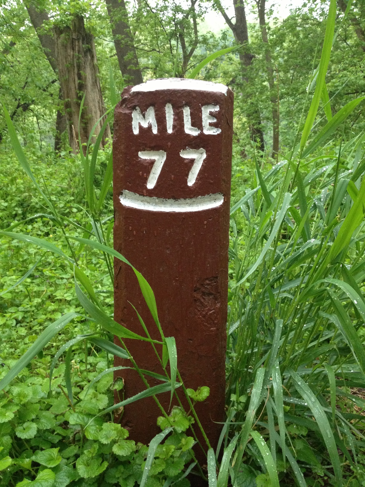
Milepost 77